Introduction
Modern cities, roads, housing projects, and industrial developments all depend on effective drainage systems. Without proper planning, heavy rainfall can cause flooding, erosion, damaged infrastructure, and costly repairs. This is why drainage design software has become an essential tool for civil engineers, environmental consultants, municipalities, and land developers.
Instead of relying on manual calculations and paper drawings, engineers now use digital software to analyze rainfall, calculate runoff, design pipe networks, and create accurate stormwater and sewer systems. These programs improve precision, reduce design errors, and help projects meet local engineering standards more efficiently.
Whether you are designing a residential subdivision, a highway drainage network, or a commercial development, the right software can save time while producing reliable hydraulic results. Many modern platforms also integrate with CAD, BIM, and GIS technologies, making collaboration easier throughout the project lifecycle.
In this guide, you will learn what drainage design software is, how it works, its key features, the different types available, and how to choose the best solution for your engineering projects.
What Is Drainage Design Software?
Drainage design software is a specialized engineering application used to plan, analyze, and design systems that safely collect and transport stormwater or wastewater. Its primary goal is to ensure that water flows efficiently through pipes, culverts, channels, detention basins, and drainage networks without causing flooding or environmental damage.
In civil engineering, drainage design involves both hydrology and hydraulics. Hydrology focuses on understanding rainfall, runoff, and watershed behavior, while hydraulics studies how water moves through pipes and channels. The software combines these disciplines to produce accurate designs based on real-world terrain and rainfall data.
Before digital tools became common, engineers performed calculations manually using spreadsheets, printed contour maps, and design charts. Although effective for small projects, manual methods were time-consuming and increased the risk of calculation errors. Modern software automates these processes by importing survey data, generating pipe profiles, sizing drainage structures, and producing detailed engineering reports.
Typical users include civil engineering firms, land development consultants, transportation agencies, municipal stormwater departments, and environmental engineering companies. Because projects vary in size, different software solutions are available for residential, commercial, industrial and regional infrastructure planning.
How Drainage Design Software Works?
Designing an effective drainage system requires much more than drawing pipes on a map. Modern drainage software follows a structured engineering workflow that transforms survey information into a complete hydraulic design.
Site Data Collection
The process begins with collecting accurate site information. Engineers import topographic surveys, digital elevation models (DEM), LiDAR scans, GPS coordinates, and existing utility maps. This terrain data helps the software understand slopes, elevations, and natural water flow across the project area. Accurate survey information is essential because even small elevation differences can significantly affect drainage performance.
Catchment Analysis
After terrain data is prepared, the software identifies drainage catchments and watershed boundaries. It calculates drainage areas, runoff coefficients, and the time of concentration for each watershed. These calculations determine how quickly rainwater reaches the drainage network during different storm events.
Hydraulic Modeling
The next stage involves hydraulic analysis. Engineers design pipe diameters, calculate flow capacity, evaluate gravity drainage systems, and apply Manning’s equation to estimate water velocity and discharge. The software also identifies potential bottlenecks that could cause flooding during heavy rainfall.
Stormwater Simulation
Finally, the software simulates rainfall events using different design storms. It predicts peak discharge, flood risk, and system performance under various weather conditions, allowing engineers to optimize the design before construction begins.
Key Features of Drainage Design Software
One of the biggest strengths of drainage design software is its ability to combine multiple engineering tasks into a single digital environment. Rather than using separate tools for calculations, drafting, and reporting, engineers can complete the entire workflow within one platform.
Stormwater modeling is one of the most valuable features. The software estimates runoff from rainfall and evaluates how water moves across developed and natural landscapes. This helps designers prevent flooding in residential neighborhoods, commercial properties, and transportation projects.
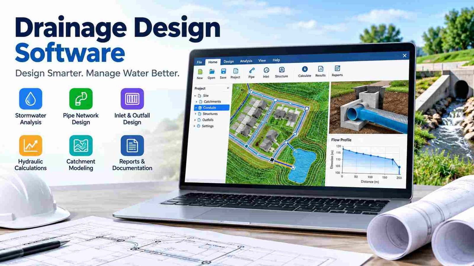
Pipe network design allows engineers to create underground drainage systems with automatic sizing and flow analysis. Instead of manually selecting pipe diameters, the software recommends suitable sizes based on hydraulic calculations and design criteria.
Another important capability is detention and retention basin design. These storage facilities temporarily hold stormwater and release it gradually, reducing downstream flood risk. The software calculates storage volume, outlet structures, and discharge rates for different rainfall events.
Modern platforms also generate longitudinal profiles, hydraulic grade lines (HGL), manhole schedules, culvert designs, and detailed engineering reports. Many solutions include both 2D plan views and 3D visualization, making it easier for engineers, contractors, and clients to understand the final drainage system before construction begins.These features improve design accuracy while reducing repetitive engineering work and documentation time.
Types of Drainage Design Software
Not every drainage project requires the same type of software. Different engineering applications are designed for specific infrastructure needs, making it important to select a solution that matches your project.
Stormwater design software focuses on urban runoff, detention ponds, sustainable drainage systems (SuDS), and rainfall management. These tools are commonly used in residential developments, shopping centers, and commercial construction where stormwater control is a priority.
Sewer design software specializes in sanitary wastewater networks. Engineers use these programs to design gravity sewer systems, analyze wastewater flow, and ensure adequate capacity for growing communities. Municipal authorities often rely on this category for long-term sewer infrastructure planning.
Highway drainage software is developed for roads, bridges, culverts, roadside ditches, and cross-drainage structures. Transportation engineers use it to manage runoff from highways while protecting pavement and surrounding land.
Urban drainage modeling software supports large municipal projects by combining stormwater, sewer networks, flood resilience, and city-wide infrastructure planning. These solutions are valuable for smart city development and climate adaptation projects.
Finally, watershed and flood modeling software analyzes rivers, regional catchments, reservoirs, and large drainage basins. Environmental consultants and government agencies often use these tools to study flood behavior and improve regional water management strategies.
Where Drainage Design Software Is Used?
Drainage infrastructure exists in almost every construction project, making drainage design software valuable across numerous industries. From small housing developments to large transportation networks, engineers depend on digital modeling to improve water management and reduce project risks.
Civil engineering firms use the software during land development planning to design stormwater systems, parking lot drainage, and utility infrastructure. Residential subdivisions require carefully designed pipe networks, catch basins, and detention ponds to protect homes from flooding during heavy rain.
Commercial developments such as shopping malls, office parks, and industrial facilities also rely on drainage modeling. These projects often include large paved surfaces that generate significant runoff, making accurate hydraulic calculations essential for compliance with local regulations.
Municipal governments use drainage software for upgrading aging stormwater systems, designing new sewer networks, and managing urban flood risks. Transportation agencies apply similar tools when designing highways, airports, railway corridors, and bridge drainage systems.
Environmental consulting companies use watershed modeling to assess the environmental impact of development projects. By analyzing natural drainage patterns and flood behavior, they help protect wetlands, rivers, and surrounding ecosystems while supporting sustainable infrastructure planning.
Because climate change has increased the frequency of intense rainfall events, drainage modeling has become even more important for resilient urban development and long-term infrastructure design.
Benefits of Using Drainage Design Software
The greatest advantage of drainage design software is improved engineering accuracy. Automated hydraulic calculations reduce human error while helping engineers evaluate multiple design scenarios much faster than traditional manual methods.
Another major benefit is productivity. Tasks that previously required hours of spreadsheet calculations and profile drafting can now be completed in minutes. Engineers can modify pipe sizes, update terrain information, or change rainfall parameters without recreating the entire design from scratch.
Flood risk management also becomes more reliable. Simulation tools allow designers to test different storm events and identify areas where drainage capacity may be insufficient. This helps prevent expensive construction changes and reduces the likelihood of future flooding.
Regulatory compliance is another important advantage. Many software platforms automatically generate engineering reports, hydraulic summaries, pipe schedules, and profile drawings required for municipal approvals. Standardized documentation improves communication between consultants, contractors, and reviewing authorities.
Collaboration has also improved significantly through CAD, BIM, and GIS integration. Surveyors, architects, structural engineers, and utility designers can share the same project data, reducing coordination problems during design and construction.Ultimately, better drainage design leads to lower maintenance costs, more sustainable water management, and longer-lasting infrastructure for communities.
Best Drainage Design Software Solutions
Several professional software platforms are widely used in the engineering industry. Each solution serves different project sizes and technical requirements rather than being universally better than the others.
Best for large civil infrastructure projects. It combines terrain modeling, pipe networks, grading and construction documentation within a BIM workflow.
Designed for stormwater analysis and sustainable drainage systems, with strong hydraulic calculations and approval-ready reporting.A free and widely respected option for rainfall-runoff simulation, sewer modeling, and hydraulic routing, making it popular in education and public-sector projects.
Focuses on storm sewer analysis, inlet capacity, and detailed pipe hydraulics for municipal and transportation infrastructure.Often selected for detention pond sizing, hydrograph routing, and practical stormwater report generation in land development.
Comparison Table
| Software | Best For | Key Strength |
| Autodesk Civil 3D | Infrastructure projects | CAD + BIM integration |
| InfoDrainage | Stormwater design | SuDS & hydraulic modeling |
| EPA SWMM | Free hydraulic analysis | Rainfall & runoff simulation |
| StormCAD | Storm sewer systems | Pipe network calculations |
| HydroCAD | Detention basins | Storage & hydrograph modeling |
Hydrology, Hydraulics and Design Integration
A successful drainage project depends on understanding both hydrology and hydraulics. Although these terms are closely related, they solve different engineering problems.
Hydrology studies where water comes from. Engineers analyze rainfall intensity, watershed boundaries, soil characteristics, land use, and runoff generation to estimate how much water enters the drainage system. For example, replacing farmland with paved roads increases runoff because less water infiltrates into the ground.
Hydraulics focuses on how that water moves after entering pipes, culverts, channels, and detention structures. It calculates flow velocity, water depth, pressure, and pipe capacity to ensure the drainage network can safely transport peak discharge without overflowing.
Modern drainage software combines these analyses with CAD, BIM, and GIS technologies. Engineers can import AutoCAD drawings, GIS shapefiles, terrain models, and LandXML survey data directly into the project. This integration eliminates duplicate work while improving collaboration between surveyors, architects, utility designers, and construction teams.
Many organizations are also adopting digital twin workflows, where drainage models remain connected to real infrastructure throughout its lifecycle. This allows future maintenance, upgrades, and flood planning to be based on accurate digital engineering data rather than outdated paper drawings.
How to Choose the Right Drainage Design Software?
Choosing the right drainage software depends on your project goals rather than simply selecting the most expensive platform. Small residential developments often need straightforward stormwater calculations, while large municipal projects require advanced hydraulic modeling and GIS integration.
Begin by considering project size. If your work involves subdivisions or commercial sites, software with strong stormwater and detention pond capabilities may be sufficient. Regional infrastructure projects typically require watershed modeling and complex sewer network analysis.
Budget is another important factor. Free tools such as EPA SWMM provide excellent hydraulic modeling, while commercial platforms offer additional productivity features, CAD integration, and technical support. Organizations should evaluate licensing costs alongside long-term efficiency benefits.Ease of learning also matters. Some applications are designed for experienced hydraulic engineers, while others provide more user-friendly interfaces suitable for consultants and smaller engineering teams.
Finally, consider compatibility with your existing workflow. Software that integrates with AutoCAD, BIM, GIS, and survey data formats reduces file conversion problems and improves collaboration across disciplines. The best solution is the one that matches your engineering requirements, team expertise, and future project growth.
Frequently Asked Questions
1. What is the main purpose of drainage design software?
Its main purpose is to design safe and efficient stormwater and sewer drainage systems by performing hydraulic calculations, runoff analysis, pipe sizing, and engineering documentation.
2. Can beginners learn drainage design software?
Yes. Many platforms include tutorials and simplified workflows, although understanding basic civil engineering and hydraulic principles will make learning much easier.
3. Is drainage design software only for large projects?
No. It is widely used for small residential developments, commercial buildings, parking lots, industrial facilities, and large municipal infrastructure projects.
4. Does drainage software help reduce flooding?
Yes. By simulating rainfall events and analyzing drainage capacity, engineers can identify flood risks and improve the design before construction begins.
5. What data is needed before starting a drainage design?
Typical inputs include topographic surveys, terrain elevations, rainfall information, watershed boundaries, land use data, and existing utility or drainage network layouts.
Conclusion
Effective water management is essential for safe and sustainable infrastructure, and drainage design software plays a vital role in achieving that goal. From stormwater modeling and sewer network design to hydraulic analysis and flood simulation, these tools help engineers create accurate, efficient, and regulation-ready drainage systems. Whether you are planning a residential subdivision, highway project, commercial development or municipal infrastructure upgrade, choosing software that matches your project size and workflow is the key to better results. By combining hydrology, hydraulics, CAD, BIM, and GIS technologies, modern drainage design software improves productivity, reduces design errors, and supports smarter long-term infrastructure planning.